GeoStreetMap
Road Map + WebGIS
GeoStreetMap
Road Map + WebGIS
Usually, the internal organization of Public Administrations is based on different departments with their own procedures regarding social administration. The Registry Office and the Land Registry are just two of many.
If the databases of these single units are not connected and shared, data inconsistency will inevitably be one the many consequences with an heavy negative impact on service quality.
Data organization and normalization will lead to an improved efficiency of public structures, as well as a higher level of satisfaction for employees, who will have all the tools needed to solve a wide range of issues.
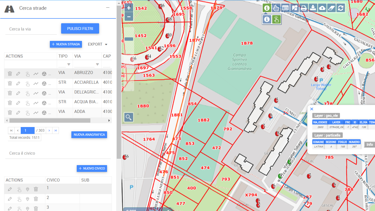
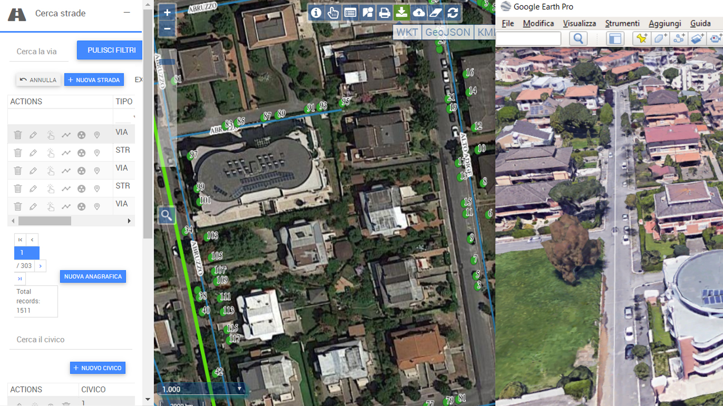
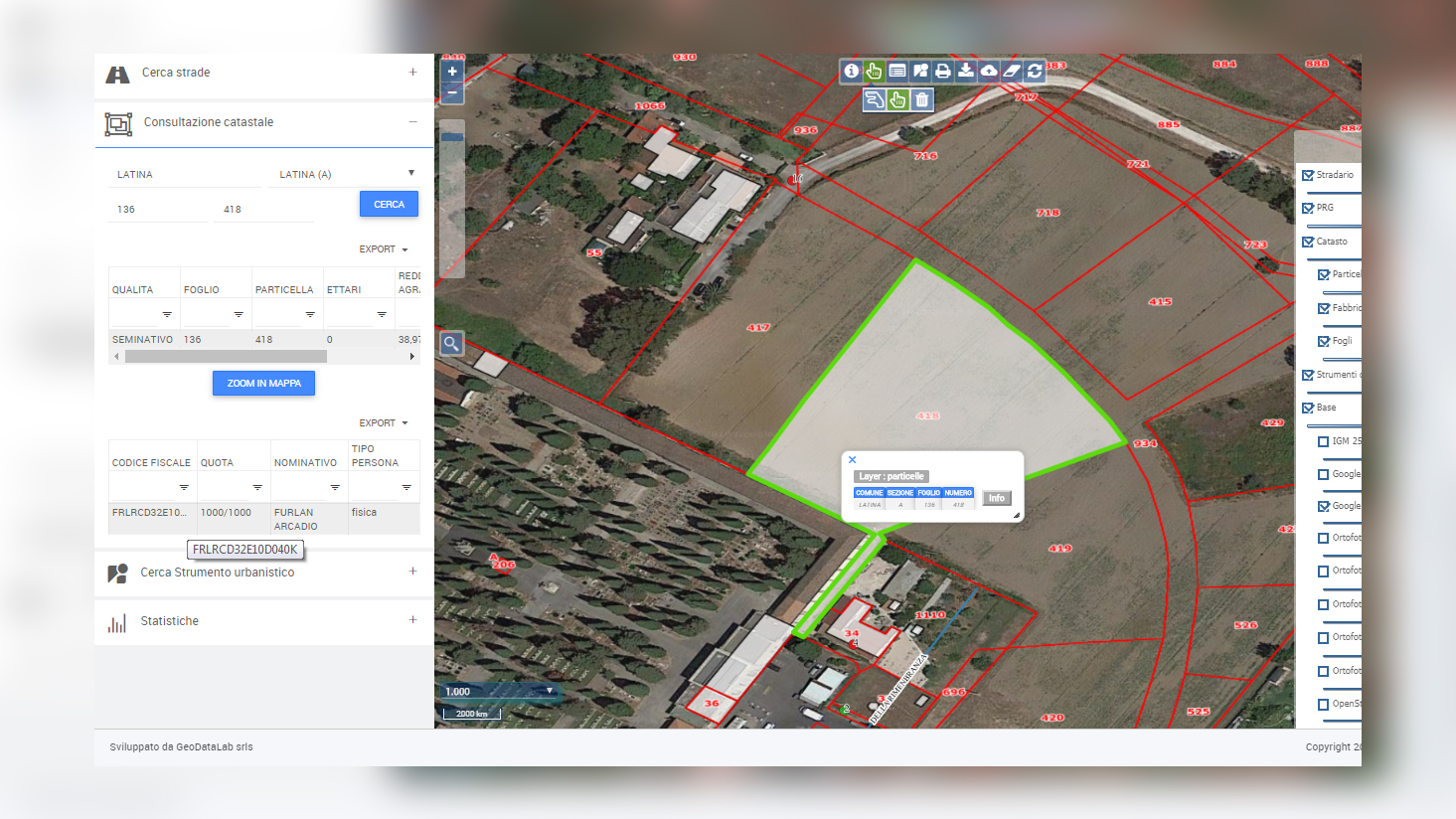
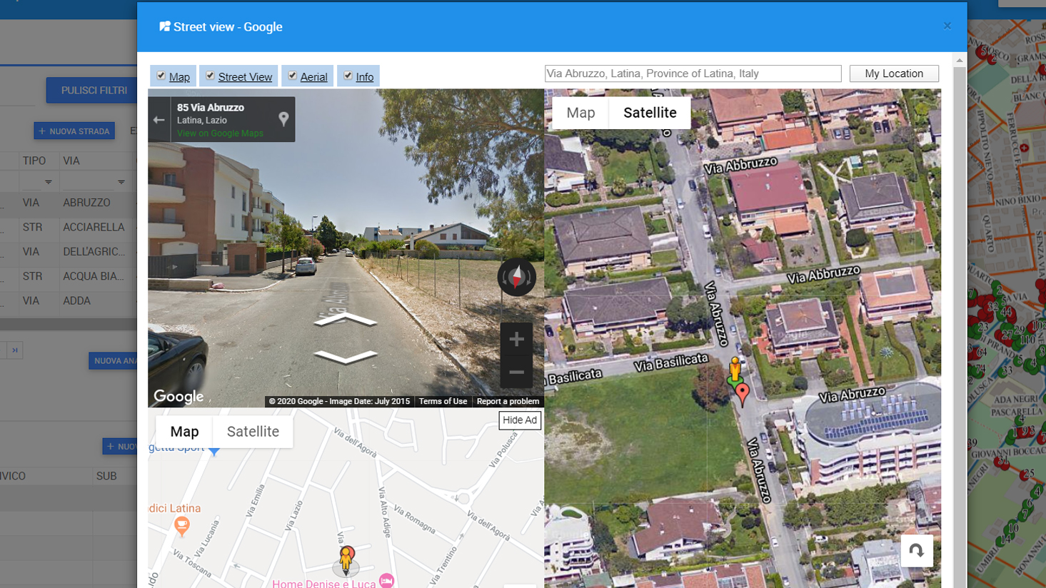
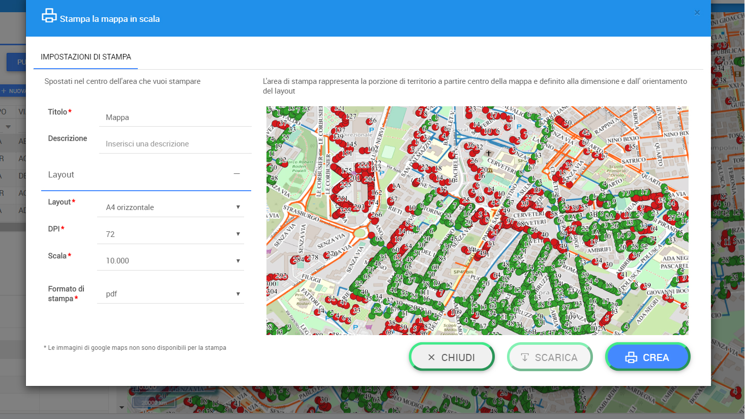
The GeoStreetMap project has given us the opportunity to perform these operations on the databases of an italian city administration’s Land Registry and Registry Office. We provided an even better and wider service including a Road Map and a WebGis, allowing navigation through the cartographic and alphanumeric data.
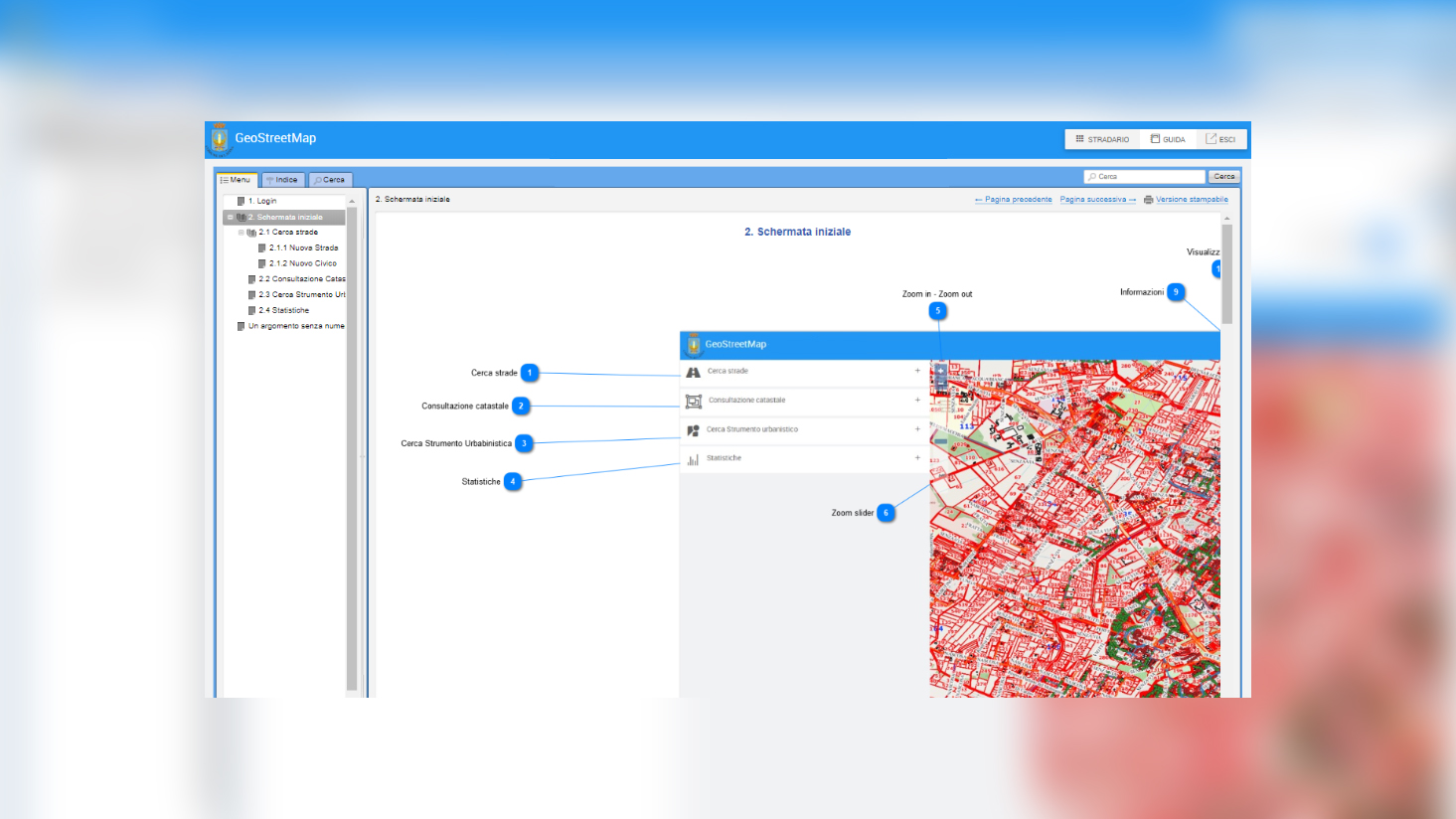
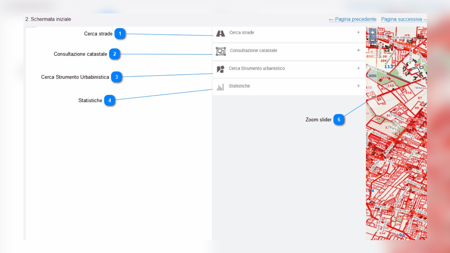
The system provides the opportunity to navigate through land registry information (cartography and ownership), road graphs and historical orthophotos of the so called General Urban Development Plan and to perform a wide range of research and data extractions.