GeoDemanio
Geographic Information System
GeoDemanio
Geographic Information System
What is the State Property Agency?
The State Property Agency is the agency in charge of state assets management and development. It operates together with regional and city administrations with the goal of protecting and increasing the state territory’s worths while contributing to the economic, productive, social and cultural development.
What are state grants?
With the goal of providing the opportunity to make the most of a territory’s resources, some areas are made available to specific projects.
These projects are subjected to a very detailed evaluation procedure verifying the purpose and the management approach
in particular towards the territory’s resources.
Which needs?
The administration’s main need is to be able to manage the applications authorization process in the most efficient way possible while keeping an eye on management costs and waste reduction, maintenance operations planning and on the safeguard of the territory’s value.
Some examples of state property?
The assets belonging to the state which are therefore a part of the so called State Public Property are established by the Civil Code.
Shores, beaches, harbours, rivers and the adjoining docks, creeks, lakes, streets, highways, railways, aerodromes, aqueducts, national defence fabrications, realties of historical, archeological and artistic interest, contents of museums, art galleries, archives and libraries.
… and state property grants?
Through so called state property grants private entities have the exclusive opportunity to benefit from public property and territories, meaning they will be allowed to work and profit on them.
The most common grant examples are: construction and openings of beach clubs, the grant of land surrounding rivers and its shores in order to build establishments and/or businesses of public interest.
Digitalization: is it worth it?
The process of digitalization and automation of the State Property Agency’s procedures opens many doors of improvement for the Public Administrations, not only in terms of better workflow: waiting time for file processing is reduced, measures efficiency is improved and an overall picture becomes available, providing the opportunity to shape every measure on a global vision approach.
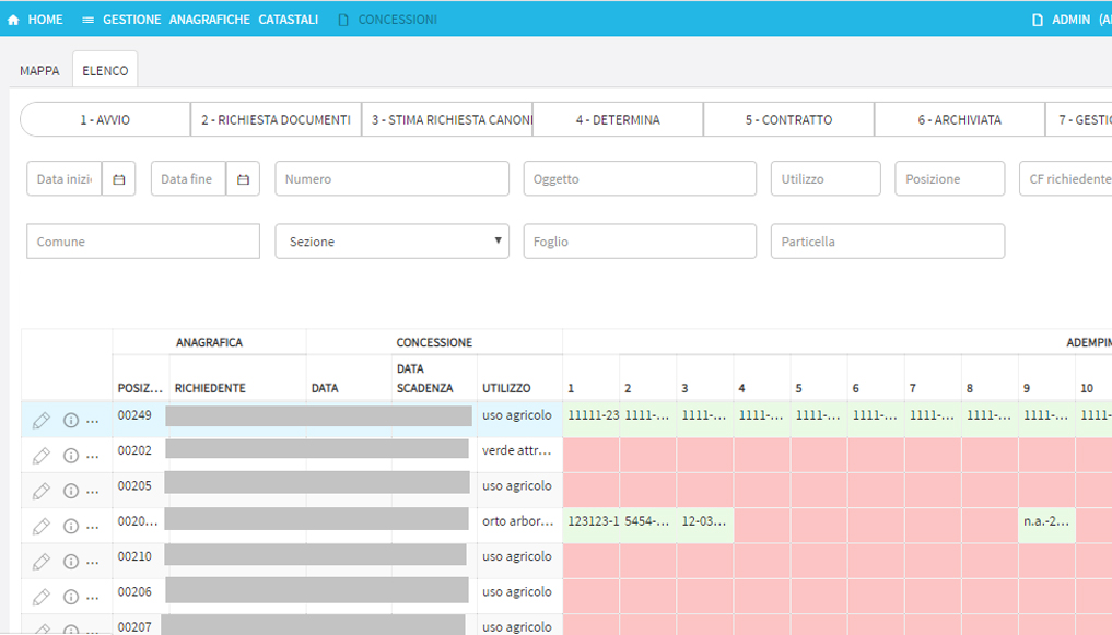
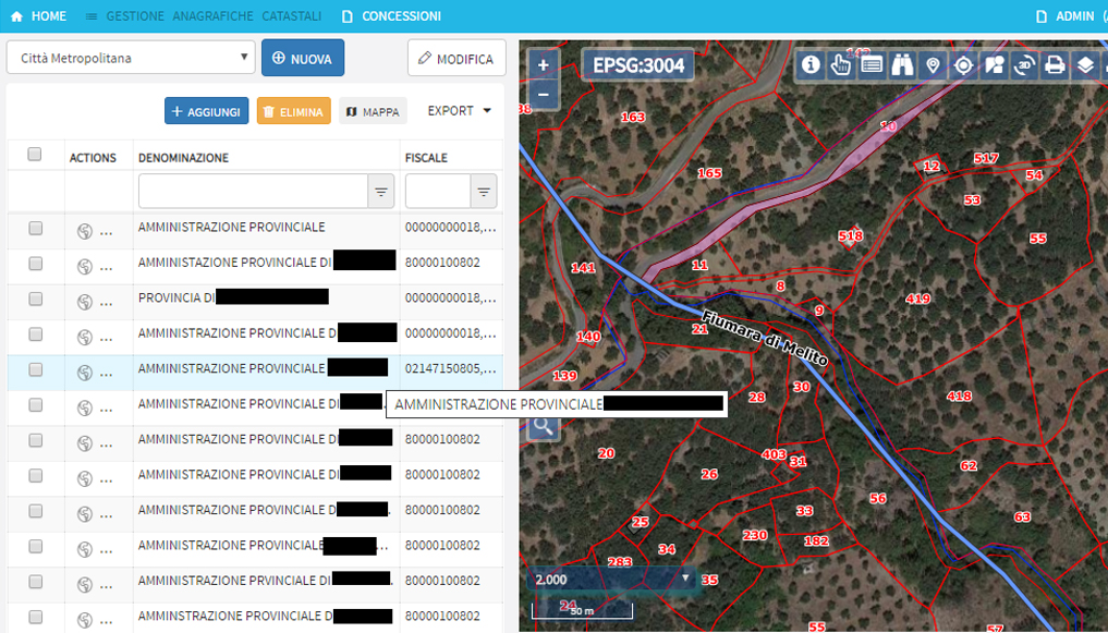
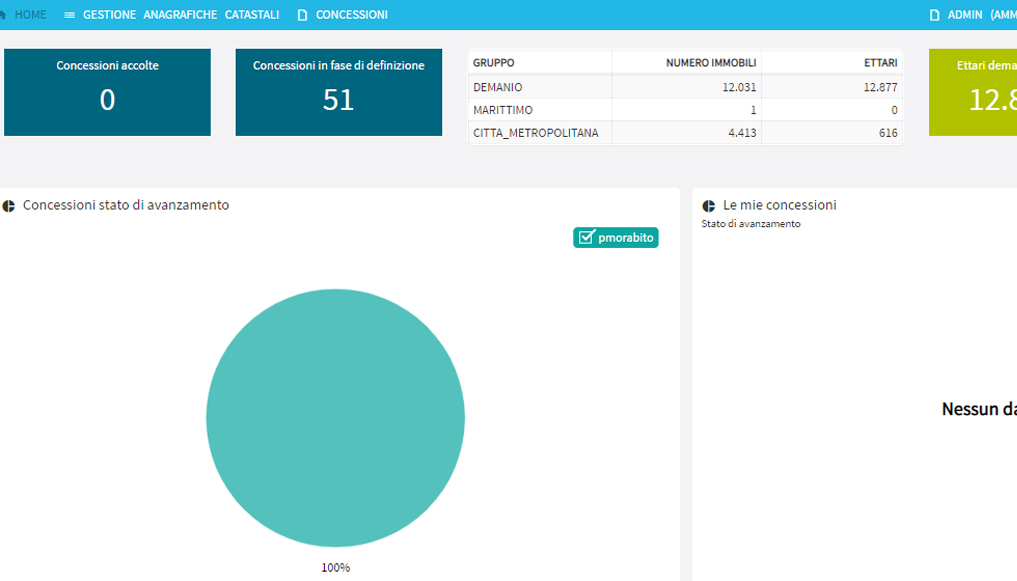
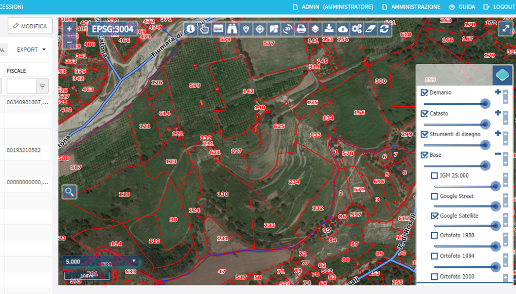
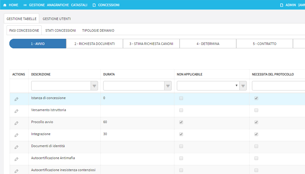
GeoDemanio is a Geographic Information System for state property management. The system provides the opportunity to set up highly automated and customized procedures based on the steps and structure defined for the administration process of grants assignments.
GeoDemanio is made of four modules: Statistics, State Property, Grants, Users.